 vesseltracker.com
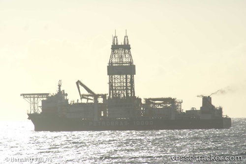
Vessel PETROBRAS 10000 IMO: 9404352, MMSI: 538090518 Drilling Ship
UTC, -22.96767, -40.72316, course: 50, speed: 0.1
UTC, -22.96767, -40.72316, course: 50, speed: 0.1
2026-02-16 18:12:24 UTC, -22.96767, -40.72367, course: 30, speed: 0.1
Live AIS position:
UTC. 26 nm SW of Fluminense FPSO),
updated 2026-02-16 18:12:24 UTC.
Find the position of the vessel PETROBRAS 10000 on the map. The latter are known coordinates and path.
marine traffic ship tracker show on live map
The current position of vessel PETROBRAS 10000 is -22.96767 lat / -40.72367 lng. Updated: 2026-02-16 18:12:24 UTCCurrently sailing under the flag of Marshall Islands
PETROBRAS 10000 built in 2009 year
Deadweight:
61403 tDetails:
Last coordinates of the vessel:
UTC, -22.96767, -40.72316, course: 50, speed: 0.1UTC, -22.96767, -40.72316, course: 50, speed: 0.1
UTC, -22.96767, -40.72316, course: 50, speed: 0.1
2026-02-16 18:12:24 UTC, -22.96767, -40.72367, course: 30, speed: 0.1